
Measured Building Survey of a Derbyshire Farmhouse Using Laser Scanning.

Accurate Farmhouse Surveys in Derbyshire by Landtech Surveys
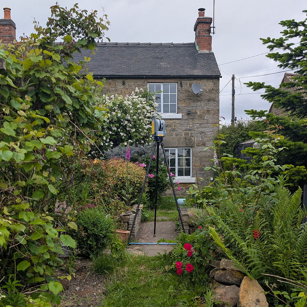
At Landtech Surveys, we recently completed a comprehensive measured building survey of a traditional farmhouse in Derbyshire. Using the latest laser scanning technology combined with a GNSS receiver to establish the Ordnance Survey National Grid, we delivered highly accurate floor plans and elevations to support the client's renovation and planning requirements.
This project demonstrates how modern surveying techniques can provide precise building data while minimising disruption to occupied properties.
Why a Measured Building Survey Was Required
The owners of this Derbyshire farmhouse required accurate existing building information to support future architectural design work. Like many rural properties, the farmhouse had undergone alterations over the years, making existing drawings either outdated or unavailable.
A measured building survey provides a detailed record of a property's dimensions, layout, and external appearance, enabling architects, planners, and property owners to make informed decisions during refurbishment, extension, or conservation projects.
Laser Scanning Technology for Maximum Accuracy
To capture the farmhouse in detail, Landtech Surveys utilised a high-precision terrestrial laser scanner. This technology rapidly collects millions of measurements from multiple positions around and within the building, creating a highly detailed three-dimensional point cloud.
The benefits of laser scanning include:
Exceptional survey accuracy
Rapid data collection
Complete building coverage
Reduced site time
Detailed records of complex architectural features
Reliable information for future design and construction work
The laser scanner captured both internal and external areas of the property, ensuring every room, wall, opening, and architectural feature was accurately recorded.

Establishing Ordnance Survey Grid Coordinates with GNSS
A GNSS (Global Navigation Satellite System) receiver was used to establish survey control on the Ordnance Survey National Grid. By georeferencing the survey data to the national coordinate system, the measured building survey could be accurately integrated with other site information, topographical surveys, planning applications, and mapping datasets.
The use of GNSS control offers several advantages:
Accurate positioning on the Ordnance Survey grid
Improved coordination with design teams
Seamless integration with wider site surveys
Consistency across future project phases
For projects involving multiple survey disciplines, georeferenced survey data provides a robust foundation for design and development.
Survey Deliverables: Floor Plans and Elevations
Following data processing and quality assurance, Landtech Surveys produced a complete set of measured survey drawings, including:
Existing Floor Plans
Detailed floor plans were generated for the farmhouse, showing:
Internal room layouts
Wall thicknesses
Door and window positions
Structural features
Staircases and circulation areas
These plans provide architects and designers with an accurate representation of the building's existing configuration.

Building Elevations
Accurate external elevations were also produced from the laser scan data, illustrating:
Building heights
Window and door arrangements
Roof profiles
External materials and architectural details
Elevation drawings are often essential for planning applications, listed building consent, heritage assessments, and architectural design work.

The Advantages of Measured Building Surveys for Farmhouses
Farmhouses and rural properties frequently present surveying challenges due to irregular construction methods, historic alterations, and complex roof structures. Laser scanning allows surveyors to capture these characteristics accurately and efficiently.
Measured building surveys are particularly valuable for:
Farmhouse renovations
Barn conversions
Heritage property restoration
Planning applications
Architectural design
Building extensions
Property management and asset documentation
Measured Building Surveys Across Derbyshire
Landtech Surveys provides professional measured building surveys throughout Derbyshire and the surrounding regions. Whether surveying historic farmhouses, residential properties, commercial buildings, or industrial facilities, our team combines advanced survey technology with extensive industry experience to deliver accurate and reliable survey information.
Using laser scanning, GNSS positioning, and modern survey workflows, we provide high-quality floor plans, elevations, sections, and 3D survey data tailored to the needs of architects, developers, property owners, and construction professionals.
Contact Landtech Surveys
If you require a measured building survey in Derbyshire, Landtech Surveys can provide accurate floor plans, elevations, and georeferenced survey data using the latest laser scanning and GNSS technology.
Contact our team today to discuss your project and discover how our measured survey services can support your design, planning, and construction requirements.
FAQ Section
What is a measured building survey?
A measured building survey is a detailed survey that records the dimensions, layout and features of a building. It typically produces floor plans, elevations, sections and other drawings required for design, planning and construction projects.
Why are laser scanners used for measured building surveys?
Laser scanners capture millions of accurate measurements in a short period of time, creating a highly detailed record of a building. This allows surveyors to produce precise drawings while reducing time spent on site.
What are the benefits of using GNSS in a building survey?
GNSS technology allows survey data to be accurately positioned on the Ordnance Survey National Grid. This ensures compatibility with topographical surveys, mapping data and future project phases.
What drawings are produced from a measured building survey?
Measured building surveys commonly produce floor plans, elevations, sections, roof plans and 3D models depending on the project requirements.
Can measured building surveys be carried out on historic farmhouses?
Yes. Laser scanning is particularly effective for surveying historic farmhouses because it accurately captures irregular building features, complex roof structures and architectural details without causing disruption.
When is a measured building survey required?
Measured building surveys are often required for planning applications, renovations, extensions, heritage projects, property management and architectural design work.
How accurate is a laser scanning survey?
Modern terrestrial laser scanners can achieve millimetre-level accuracy, making them one of the most reliable methods for capturing existing building information.


Comments