
Topographical Survey for a Residential Development Near Belper, Derbyshire


As residential developments progress through construction, having an accurate record of the current site conditions can be extremely useful to developers, contractors, architects and other professionals involved in the project.
Landtech Surveys was recently commissioned to undertake a construction progress topographical survey for a small residential development near Belper, Derbyshire.
The development consisted of three new dwellings. At the time of our survey, two of the properties had been completed, while construction of the third was still underway.
The purpose of the survey was to provide the client with an accurate site update, recording the current position and levels of the development as construction progressed. In addition to the detailed topographical survey, the client also required a georeferenced aerial image to provide wider visual context of the site and its surroundings.
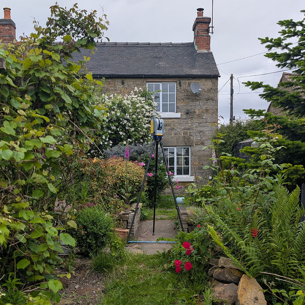
To complete the survey efficiently and accurately, we combined Trimble X7 laser scanning, Trimble R12 GNSS surveying and a DJI Matrice 4E RTK drone.

Topographical construction progress survey near Belper
Unlike a survey carried out before construction begins, a construction progress survey provides an updated picture of what is actually on the ground at a particular stage of a development.
On this project, the client wanted to establish an accurate record of the site as construction progressed, including the two completed properties and the partially completed third dwelling.
The survey captured the existing and newly constructed features across the development, providing the client with an up-to-date CAD drawing and aerial imagery that could be used alongside the previous survey information.
This type of construction site survey can be particularly useful where a development has changed considerably since the original topographical survey was undertaken.
Detailed site survey using Trimble X7 laser scanning
The main survey of the development was completed using our Trimble X7 laser scanner.
The X7 was used to capture the detailed information required within the site boundary. Laser scanning allowed us to collect a large amount of three-dimensional information efficiently, including buildings, structures, boundaries and ground features.
The survey included:
Existing and new buildings
Building footprints
Roof ridge and eaves heights
Ground levels
Boundary walls
Fences
Hedges
Retaining walls
Roads and kerblines
Manholes
Services
Site access
Other relevant site features
The resulting laser scan data provided a detailed point cloud from which the required survey information could be extracted for the final CAD drawing.
For a developing residential site, this approach provides a very detailed record of the physical features present at the time of the survey.

Using GNSS to connect the survey to the original site control
An important part of this project was ensuring that the new survey could be accurately related to the original topographical survey.
The original survey had been completed several years earlier by another surveying company, but existing survey control from that project was still present on site.
We used our Trimble R12 GNSS receiver to locate and check the existing site control and use it as the basis for the new survey.
This meant that the new information could be tied back into the coordinate system and survey framework established by the earlier survey.
Maintaining consistency between different stages of a development can be particularly important where surveys are carried out by different companies and at different points during the construction process.
It also means that the client can compare the latest survey information with previous drawings with greater confidence.
DJI Matrice 4E RTK drone survey
Alongside the detailed ground survey, we used our DJI Matrice 4E RTK drone to capture aerial imagery of the development and its surrounding area.
Just over 100 aerial images were captured during the survey.
The drone data provided additional information beyond the main site boundary, giving the client a useful overview of the development and its surrounding environment.
The drone point cloud was not intended to replace the detailed laser-scanned survey of the site itself. Instead, it provided additional wider-area context around the accurately surveyed site.
This combination of technologies allowed us to use the most appropriate surveying method for each part of the project.

Combining laser scanning and drone surveying
One of the advantages of using several surveying technologies on a project is that each method can be used for what it does best.
For this development:
Trimble X7 laser scanning provided the detailed survey information required within the site boundary.
Trimble R12 GNSS provided accurate survey control and allowed the new survey to be connected to the existing site control.
DJI Matrice 4E RTK provided aerial photography and additional point-cloud information covering the wider area.
Together, these datasets provided both the accurate measured survey information and the visual context that the client required.

Surveying a particularly steep development site
The development was located on a very steep site, which presented an additional consideration when carrying out the survey.
The steep terrain meant that careful positioning of equipment was important when working across the site.
Interestingly, the steepness of the site also provided an advantage for the drone survey. At the top of the site there was a suitable area from which to safely take off and land the Matrice 4E.
The elevated position also provided a good operational location for capturing the aerial imagery required for the project.
Georeferenced orthophoto for the development
As well as the topographical survey drawing, the client required a georeferenced orthophoto of the site.
The aerial imagery was processed to create an accurately positioned image that could be used in conjunction with the survey information.
The orthophoto was supplied separately to the client and was also merged onto the CAD drawing to provide additional visual context.
This can be particularly useful on construction projects because an aerial image can make it much easier to understand the relationship between the surveyed features and the wider development.
Rather than relying solely on linework, the client can see the actual appearance of the site at the time the survey was undertaken.

A five-hour site survey
Despite the steep terrain and the amount of information required, the complete site survey was carried out in approximately five hours on site.
The combination of laser scanning, GNSS and drone technology allowed us to collect the required information efficiently without compromising the level of detail required for the survey.
The use of modern surveying equipment is particularly valuable on active construction sites, where minimising time spent on site can be important.
From site survey to completed CAD drawing
Following the site visit, the survey data was processed and the required information extracted to produce the final topographical survey.
The client received:
DWG CAD topographical survey
PDF survey drawing
Georeferenced aerial image
The completed drawing incorporated the relevant existing and newly constructed features captured during the survey, while the aerial image provided additional context.
The survey drawing and imagery were completed and ready for the client within a couple of days of the site visit.
Why construction progress surveys are useful
A construction site can change significantly in a relatively short period of time.
Buildings are constructed, ground levels change, access arrangements develop and new walls, services, drainage and other infrastructure are installed.
An original topographical survey therefore provides a snapshot of the site at one particular point in time. As construction progresses, an updated survey can provide an accurate record of what is actually present.
A construction progress survey can help developers and project teams to:
Record the current state of a development
Check existing and newly constructed features
Monitor changes to ground levels
Update design information
Provide accurate CAD information
Compare current conditions with previous surveys
Record site conditions for project documentation
Provide accurate aerial imagery of the development
Support architects, engineers and other project professionals
In this case, being able to tie the new survey into the original site control also provided continuity between the earlier survey and the current construction-stage information.
Combining traditional surveying with modern technology
This project is a good example of how different surveying technologies can work together on a modern residential development.
While the DJI Matrice 4E RTK drone provided an efficient way of capturing aerial information and wider site context, the Trimble X7 laser scanner provided the detailed three-dimensional survey data required within the development.
The Trimble R12 GNSS receiver provided the survey control necessary to connect the new work to the existing site control.
Rather than relying on one technology for the entire project, we were able to combine the strengths of all three systems to produce a comprehensive and accurately positioned survey.

Land Surveyors near Belper and across Derbyshire
Landtech Surveys provides topographical surveys, construction site surveys, drone surveys, laser scanning and GNSS surveying for residential developments, commercial projects, planning applications and construction projects throughout Derbyshire and the wider East Midlands.
Our combination of Trimble X7 laser scanning, Trimble R12 GNSS and DJI RTK drone technology allows us to undertake projects ranging from relatively small residential developments through to larger and more complex sites.
For this project near Belper, the complete survey took approximately five hours on site, with the final DWG, PDF and georeferenced aerial image available within a couple of days.
Request a Topographical Survey
If you are looking for experienced topographical surveyors in Derbyshire, Nottinghamshire , East Midlands or further afield, Landtech Surveys can help.
Contact us to discuss your project and find out what information we would recommend surveying.
Landtech Surveys Telephone: 07795 286 130
Website: www.landtechsurveys.co.uk
Get in touch today for a free, no-obligation quotation for your topographical survey.
Frequently Asked Questions
What is a construction progress survey?
A construction progress survey provides an accurate record of the physical features, positions and levels present on a construction site at a particular stage of a development. It can be used to update information from an earlier topographical survey as construction progresses.
What is included in a topographical survey?
A topographical survey can record ground levels and physical features such as buildings, walls, fences, hedges, roads, kerbs, drainage, manholes, trees, retaining walls and other relevant site features. The exact information captured depends on the requirements of the project.
Can a new survey be connected to an old topographical survey?
Yes. Where suitable existing survey control remains on site, it may be possible to use that control to connect a new survey to the coordinate system of an earlier survey. This can be particularly useful during long-running construction projects.
Why use a drone for a topographical survey?
An RTK drone can efficiently capture aerial imagery and point-cloud data over large or difficult-to-access areas. It can provide useful wider site context alongside more detailed ground-based surveying techniques.
Is drone surveying a replacement for laser scanning?
Not necessarily. Different surveying methods have different strengths. In this project, laser scanning was used for the detailed survey within the site boundary, while the drone provided additional aerial information and wider context.
What is a georeferenced orthophoto?
A georeferenced orthophoto is an aerial image that has been accurately positioned within a known coordinate system. This means it can be used alongside CAD drawings and other spatial data.
How quickly can a topographical survey be completed?
The timescale depends on the size and complexity of the site and the information required. For this residential development near Belper, the site survey took approximately five hours and the completed survey drawing and imagery were ready within a couple of days.



Comments